

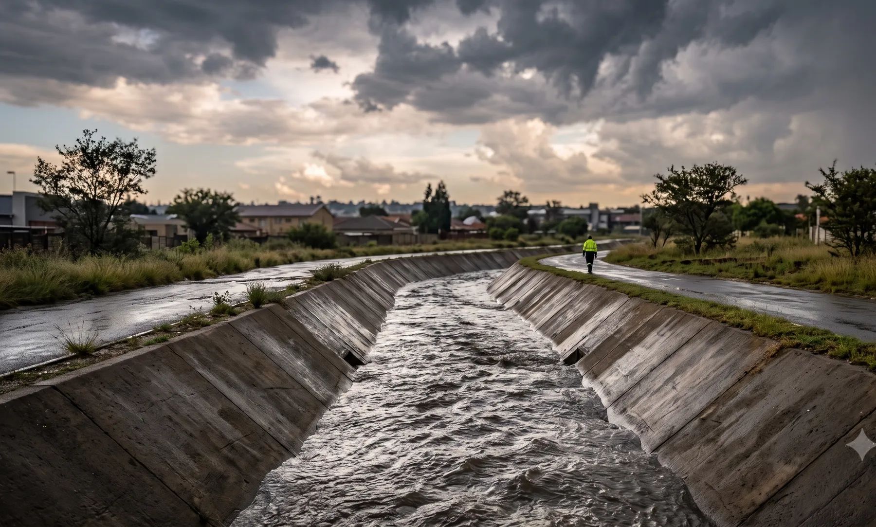
Johannesburg sits on a continental divide. North of the Witwatersrand ridge, the Jukskei, Braamfontein Spruit and Klein Jukskei drain to the Crocodile River and the Limpopo. South of it, the Klipspruit and Klip River drain Soweto and the southern suburbs to the Vaal. Both systems run through dense, hard-surfaced catchments that respond within minutes to summer thunderstorms. The City’s land use scheme now bars development inside the 1:100-year flood area, and its by-laws require a professional engineer approved by the Johannesburg Roads Agency to determine the floodplain.
Rivers that shape flood risk in Johannesburg
Loading map…
| River | Where it runs | What matters for flood studies |
|---|---|---|
| Jukskei | Rises under Ellis Park in Doornfontein and flows north through Alexandra to join the Crocodile River | Rated highly modified by the Department of Water and Sanitation; water imported from the Vaal and treated effluent keep it flowing all year |
| Braamfontein Spruit | Rises in the grounds of Barnato Park High School in Berea and runs north to the Jukskei | Covered and canalised near its source; the Sand Spruit is its largest tributary |
| Klein Jukskei | Rises in Florida Hills and runs towards Olivedale | A Jukskei tributary draining the north-western suburbs |
| Klipspruit | Drains Soweto and joins the Klip River | Protea Glen, Kliptown and Klipspruit flooded in December 2022 |
| Klip River | The main river draining Johannesburg south of the Witwatersrand | Joins the Vaal just upstream of the Vaal Barrage; dolomite underlies its wetland |
| Bloubosspruit | Rises in the koppies of Ridgeway, north of Mondeor, and joins the Klip in the Klipriviersberg Nature Reserve | A south-side tributary of the Klip |
Rain falls almost entirely in summer: about 740 mm a year at OR Tambo, close to 90% of it between October and March (WMO normals, 1991–2020). The floods come from short, intense convective storms, often with hail, falling on heavily built-up catchments.
Recent floods
- December 2022. Floods on 9 to 11 December affected 10 008 people and 3 336 formal and informal homes, and displaced 1 014 people; the City declared a local disaster on 16 December (City of Johannesburg). Klipspruit, Meadowlands, Dobsonville, Protea North and Alexandra were among the worst hit, and the hardest-hit areas were informal settlements near rivers, below the flood lines (IFRC). In Protea Glen, houses built on a wetland about ten years earlier flooded (Sowetan).
- 3 December 2022. A flash flood on the Jukskei swept away worshippers at a baptism in Bramley Park, next to Alexandra; 14 people died (eNCA).
- February 2020. The Jukskei burst its banks at Setswetla in Alexandra and 200 families were relocated (TimesLIVE).
- November 2016. About 90 mm fell at OR Tambo in a single storm, at least six people died across Gauteng, and the province declared a disaster covering Johannesburg and Ekurhuleni (SAnews).
The City’s own disaster management map lists flood hotspots in Ivory Park, Alexandra, Kliptown, Klipspruit West, Protea, Orlando West, Doornkop, Diepsloot West, Kya Sands and Bruma.
Floodline and stormwater rules in Johannesburg
- Stormwater Management By-laws (2010). The floodplain is land next to a watercourse with a catchment over 30 ha that floods on average once in 100 years “as determined by a professional engineer”, and at least 32 m either side of the centre line. The engineer must be a registered professional engineer or technologist approved by the Johannesburg Roads Agency. Documents for work within a floodplain, or within 100 m of a watercourse’s centre line, must be prepared by one.
- Permits. The Agency’s permit is needed for major developments (500 m² of new hard surface, 4 000 m² of disturbed land or 5 000 m³ of earthworks), for any clearing within a floodplain, and for berms that impound more than 450 mm or 50 m³.
- Attenuation (section 38). Post-development peaks for the 5- to 25-year storms, or up to the 50-year storm if the Agency requires it, may not exceed pre-development peaks. No attenuation pond may sit below the 50-year floodline. The Agency’s Code of Procedure requires on-site attenuation for developments on land over 8 500 m².
- Land Use Scheme 2018 (2025 review), clause 50(3)(a). No development within the area flooded by a 1:100-year flood, or within the riparian zone plus a buffer of up to 50 m, whichever is greater.
See attenuation requirements by metro, berms, levees and flood walls and the lines that control building near a river.
Where to find an existing floodline
The City’s online maps include 50-year and 100-year floodline layers, but only for the Klip River and Klipspruit catchment, determined from 25 cm contours and indicative only. North of the divide, including the Jukskei and Braamfontein Spruit, there is no published floodline layer. The same map server has wetland audit, dolomite and sinkhole layers that are worth checking on any site. Our guide on checking whether a property is in a floodline covers the rest.
Approvals beyond the City
The divide also splits the water authorities. North of it, water use in the Jukskei system falls in the Limpopo-Olifants water management area; south of it, the Klip River falls under the Vaal-Orange Catchment Management Agency. Applications are made online through the Department of Water and Sanitation’s e-WULAAS system, and the Department’s Gauteng office is in Pretoria. Our guide to getting permission to build in a floodplain sets out the order of approvals.
What to settle early on a Johannesburg site
- Which side of the divide. It decides the water authority and the downstream river system.
- Who signs. The by-laws want an engineer approved by the Johannesburg Roads Agency, so check that before the study starts.
- Dolomite. Parts of the south, including the Klip River wetland, are underlain by dolomite. Ponds and soakaways on dolomite need a geotechnical view before they are designed.
- Upstream hard surfaces. Johannesburg’s rivers carry imported water and effluent all year and rise fast in a storm, so a floodline drawn on an old catchment condition can be well out.
- Informal settlements on the banks. Riverbank settlements in Alexandra and Soweto make the flood path downstream of a development a safety question as well as a property one.
To brief a study, see our floodline determination and flood risk assessment services, or send us the site. You can drop a pin on the map in the contact form.
Local rules, rivers and flood records checked October 2026 by Robert Fortuin . Rules change, so confirm them with the municipality before relying on them.
Documents referenced
Links go to official government copies wherever one is published online. Check for amendments before relying on a specific clause.
- Stormwater Management By-laws, 2010By-law · City of Johannesburg
- City of Johannesburg Land Use Scheme 2018 (2025 review)By-law · City of Johannesburg
- Roads & Stormwater Manual, Vol 1: Code of ProcedureGuideline · Johannesburg Roads Agency
- eServices Online MapsMap viewer · City of Johannesburg
- River Health Programme: Crocodile West Marico WMA, Technical Report 3 (2015)Guideline · Department of Water and Sanitation
Services available in Johannesburg
Each link opens a brief for that service in Johannesburg: regional context, typical drivers, and how we would approach a study in the area.
- Floodline Determination
- Flood Risk Assessment
- Stormwater Management Plans
- Drainage Design
- Hydrological Studies
We take on the rest of our services in Johannesburg too.
Beyond consulting in Johannesburg
Our work in Johannesburg fits into a broader practice: flood risk intelligence for insurers, custom software for water teams, and dedicated sector hubs covering the audiences we serve.
Flood Risk Intelligence
Hazard maps, portfolio exposure, claims-dispute support, and post-event loss modelling.
Explore offerings
Custom Software
QGIS plugins, dashboards, data pipelines, bespoke applications — built around your workflow.
Explore offerings
Sectors we work with
Insurance, mining, municipalities, developers, consulting engineers, and roads & rail.
All sectors
Talk to an engineer about work in Johannesburg
Get in touch