

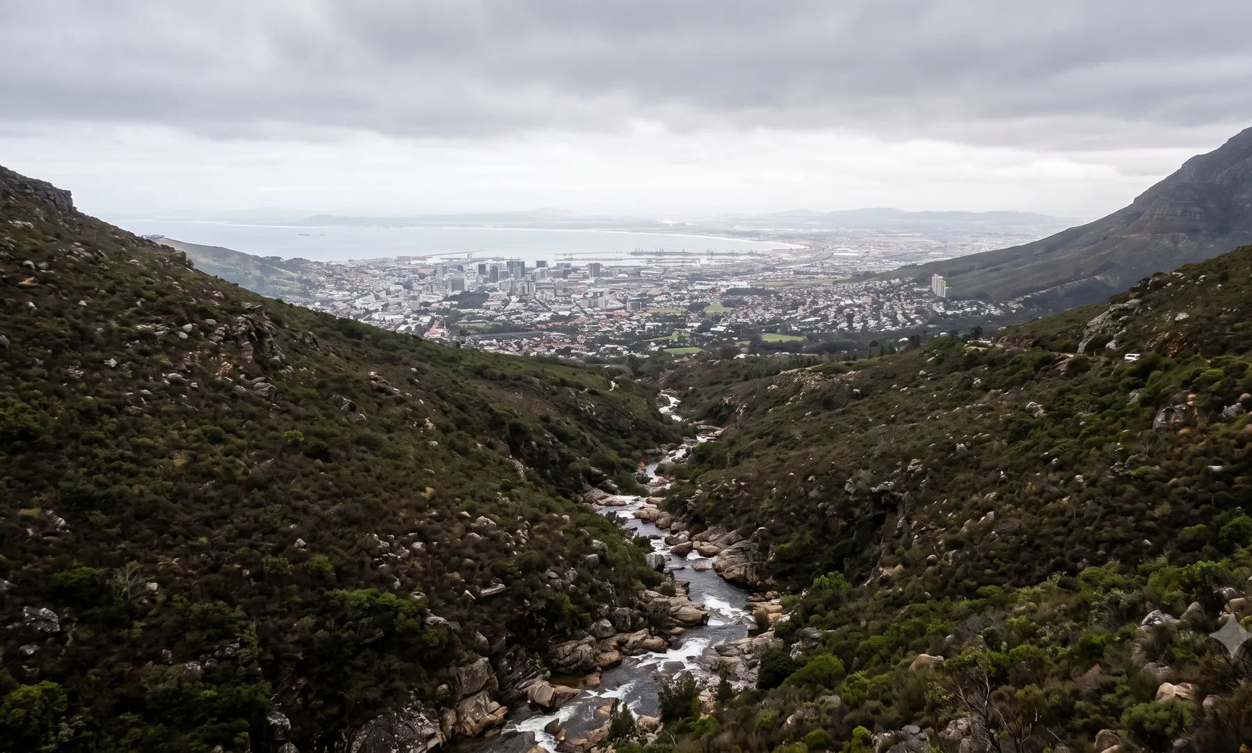
Most floodline work in Cape Town is on four river systems: the Salt River (with the Liesbeek, Black and Elsieskraal), the Diep and Mosselbank in the north, the Kuils and Eerste flowing to False Bay, and the canalised rivers of the Cape Flats. The City has the most detailed floodline rules of any municipality we have studied. Lines are drawn to the energy level, filling is barred below the 1:50-year line, and floors must sit above the 1:100-year level. The City publishes no floodline map, so most sites near a watercourse need a study.
Rivers that shape flood risk in Cape Town
Loading map…
Rainfall is the first thing to understand. It falls mainly in winter, and ranges from over 2 000 mm a year in the mountains to under 300 mm on parts of the flats (DWAF State of Rivers report, 2005). Steep mountain catchments drain onto flat, sandy lowlands with a high water table, where many rivers were straightened into canals as the city grew.
| River | Where it runs | What matters for flood studies |
|---|---|---|
| Liesbeek | Rises on Table Mountain above Kirstenbosch and runs under 9 km to Observatory | Largely canalised from Rondebosch; joins the Black River at Observatory to form the Salt River |
| Black River | Drains the north-western Cape Flats | About 55% canalised; meets the Liesbeek at Observatory |
| Elsieskraal | Drains the Tygerberg Hills | About 65% canalised; a Salt River tributary |
| Salt River | Formed where the Liesbeek and Black rivers meet; its catchment is about 270 km² | Reaches Table Bay through the Salt River Outlet Canal near Paarden Eiland |
| Diep River and Mosselbank | The Diep rises near Malmesbury and runs about 65 km through Rietvlei to Table Bay at Milnerton; the Mosselbank drains Durbanville and Kraaifontein | Catchment of 1 495 km²; Rietvlei fills only when the river overtops its banks |
| Kuils River | From the Durbanville Hills through Bellville, Kuils River, Delft, Mfuleni and Khayelitsha | Wastewater has more than doubled its flow; wetlands on the lower river attenuate floods |
| Eerste River | From the Stellenbosch mountains to False Bay at Macassar | Burst its banks in September 2023; the estuary sits high and is only slightly tidal |
| Lotus River | Southern Cape Flats | About 95% canalised; formerly seasonal wetlands; Zeekoevlei, Princessvlei and Rondevlei attenuate floods |
| Lourens River | Rises in the Hottentots Holland and runs almost 20 km through Somerset West to Strand | South Africa’s only river declared a Protected Natural Environment; burst its banks in June and September 2023 |
Two naming traps catch people. The Sand River, which feeds Zandvlei at Muizenberg with the Keysers and Westlake rivers, starts in Constantia as a second “Diep River”. And the Liesbeek is spelled “Liesbeeck” on many maps.
Recent floods
Floods in Cape Town come from winter cold fronts and cut-off lows. In every recent event, most of the damage was to homes in low-lying, flood-prone areas, many of them informal settlements on wetlands and stormwater corridors rather than on a mapped river.
- May 2026. Two cold fronts on 10 and 11 May. By 12 May, 10 703 structures and about 41 635 people had been affected in at least 26 informal settlement areas (Mail & Guardian). The storms were declared a national disaster for four provinces (Notice 7514 of 2026).
- July 2024. About 158 000 people affected and 47 663 structures flooded or damaged (The Mercury).
- June 2024. 41 informal settlements flooded, from Khayelitsha and Gugulethu to Strand, Sir Lowry’s Pass Village and Hout Bay (Cape Argus).
- September 2023. The Lourens and Eerste rivers burst their banks and 170 people were evacuated at Sir Lowry’s Pass Village (Cape Town ETC). Declared a national disaster (GN 4035 of 2023).
- June 2023. The Jakkalsvlei Canal and the Lourens and Keysers rivers breached their banks (GroundUp).
- July 2020. The Diep River burst its banks and flooded hundreds of homes in Zwelitsha, Milnerton (GroundUp).
Floodline and stormwater rules in Cape Town
Cape Town’s rules sit in a by-law, two policies and the City’s roads and stormwater standards:
- Floodplain and River Corridor Management Policy (2009). Floodlines are drawn to the theoretical energy level, not the water surface, and the foreseeable ultimate development of the catchment must be considered when calculating runoff. The 20-, 50- and 100-year lines each control something different. No new rights are granted in the high hazard zone, filling is not permitted below the 1:50-year line, and for most development the policy allows, floors must be above the 1:100-year flood level. Development in the floodplain needs a registered professional engineer’s report.
- Stormwater Management By-law (2005). Watercourses and their floodplains are part of the stormwater system. Written consent is needed to build or fill next to it, or for any activity that may raise flood levels, and the City can require floodlines to be determined at the applicant’s cost.
- Standards and Guidelines for Roads and Stormwater (v3.0, 2022). Floors at least 250 mm above the 1:100-year flood level, measured to the energy level, for new urban developments; on-site treatment and attenuation for sites over 4 000 m²; and a design rainfall grid that includes 15% for climate change in attenuation and treatment calculations.
- Management of Urban Stormwater Impacts Policy (2009). “Pre-development” means before any development on the property. Peaks up to the 10-year storm must return to that level; peaks up to the 50-year storm, to existing development levels.
Our guides explain these rules in more detail: the lines that control building near a river, filling in a floodplain, freeboard and floor levels and attenuation requirements by metro.
Where to find an existing floodline
The City Map Viewer shows watercourses, wetlands, drainage catchments and 5 m contours, but no floodline layer. Floodlines are held by the City’s Catchment, Stormwater and River Management branch, or determined by the developer for an application. The Western Cape’s provincial floodline maps cover the Breede, the Berg estuary and the Groot and Klein Brak, nothing in Cape Town, and its flood hazard index is a screening layer only. Our guide on checking whether a property is in a floodline covers what to look for on record.
Approvals beyond the City
Work in a watercourse or its regulated area is a water use. In Cape Town, water use applications go through the Breede-Olifants Catchment Management Agency, formed by merging the Breede-Gouritz and Berg-Olifants water management areas; its public contact points are in Bellville, Worcester, Clanwilliam and George. Listed activities near a watercourse also need environmental authorisation from the Western Cape’s environment department. Our guide to getting permission to build in a floodplain sets out the order of approvals.
What to settle early on a Cape Town site
- Which line applies. Obstructions are controlled inside the 20-year line, filling below the 50-year line, and floor levels against the 100-year line.
- Energy level, not water surface. In fast-flowing reaches, the energy level can sit well above the water surface, and Cape Town measures from it.
- The future catchment. Upstream development counts, so a floodline drawn for today’s catchment may be rejected.
- Groundwater. On the Cape Flats sands, a high water table limits infiltration and affects basements and attenuation ponds.
- The coast. Storm surge was named in both the 2023 and 2026 disaster classifications, and estuary mouths such as Zandvlei’s are opened artificially, which changes flood levels behind them.
To brief a study, see our floodline determination and flood risk assessment services, or send us the site. You can drop a pin on the map in the contact form.
Local rules, rivers and flood records checked October 2026 by Robert Fortuin . Rules change, so confirm them with the municipality before relying on them.
Documents referenced
Links go to official government copies wherever one is published online. Check for amendments before relying on a specific clause.
- Floodplain and River Corridor Management PolicyPolicy · City of Cape Town
- Stormwater Management By-law, 2005By-law · City of Cape Town
- Management of Urban Stormwater Impacts PolicyPolicy · City of Cape Town
- Standards and Guidelines for Roads and Stormwater, Version 3.0 (February 2022)Standard · City of Cape Town
- City Map ViewerMap viewer · City of Cape Town
- State of Rivers Report: Rivers of the City of Cape Town (2005)Guideline · Department of Water Affairs and Forestry, River Health Programme
Services available in Cape Town
Each link opens a brief for that service in Cape Town: regional context, typical drivers, and how we would approach a study in the area.
- Floodline Determination
- Flood Risk Assessment
- Stormwater Management Plans
- Drainage Design
- Hydrological Studies
We take on the rest of our services in Cape Town too.
Beyond consulting in Cape Town
Our work in Cape Town fits into a broader practice: flood risk intelligence for insurers, custom software for water teams, and dedicated sector hubs covering the audiences we serve.
Flood Risk Intelligence
Hazard maps, portfolio exposure, claims-dispute support, and post-event loss modelling.
Explore offerings
Custom Software
QGIS plugins, dashboards, data pipelines, bespoke applications — built around your workflow.
Explore offerings
Sectors we work with
Insurance, mining, municipalities, developers, consulting engineers, and roads & rail.
All sectors
Talk to an engineer about work in Cape Town
Get in touch