

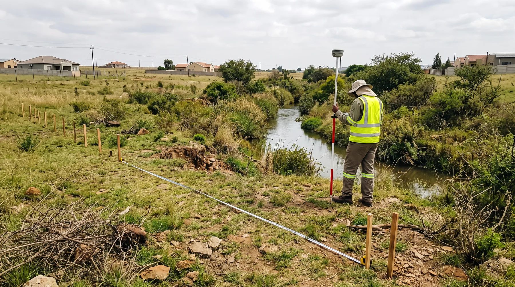
The 32 m Rule Explained: NEMA Activities 12 and 19 Near a Watercourse
· Written by Stephan Dreyer · Reviewed by Robert Fortuin
The 32 m rule is not a buffer you may never build in. It is a trigger in the environmental impact assessment (EIA) regulations under the National Environmental Management Act (NEMA): build a structure of 100 m² or more within 32 m of the edge of a watercourse, outside an urban area, and you need environmental authorisation before you start. A second activity catches earthworks in the watercourse itself, in town or out of it, and a third lowers the footprint to 10 m² in sensitive areas.
Planning work near a river, stream or wetland? We map the watercourse, the floodline and the regulated area, and give your environmental practitioner the hydrology the application needs.
Flood risk assessmentActivity 12: structures within 32 m
Listing Notice 1 (GN R983 of 2014, as amended by GN 327 of 2017), activity 12, lists the development of:
- dams or weirs where the dam or weir, including infrastructure and water surface area, exceeds 100 m²; or
- infrastructure or structures with a physical footprint of 100 m² or more;
where the development occurs “(a) within a watercourse; (b) in front of a development setback; or (c) if no development setback exists, within 32 metres of a watercourse, measured from the edge of a watercourse”.
It then excludes:
- infrastructure inside existing ports or harbours that does not enlarge their footprint, and port development, which falls under Listing Notice 2;
- activities that Listing Notice 2 or Listing Notice 3 activity 14 covers, in which case that activity applies instead;
- development “within an urban area”;
- development within existing roads, road reserves or railway line reserves;
- temporary infrastructure removed within six weeks of starting, where no indigenous vegetation is cleared.
Activity 48 applies the same test to expansions: enlarging a structure’s footprint, or a dam or weir, by 100 m² or more within a watercourse or within 32 m of one, with the same urban and road reserve exclusions.
Activity 19: moving material in a watercourse
Activity 19 of Listing Notice 1 lists “the infilling or depositing of any material of more than 10 cubic metres into, or the dredging, excavation, removal or moving of soil, sand, shells, shell grit, pebbles or rock of more than 10 cubic metres from a watercourse”.
Two things set it apart from activity 12. It applies to the watercourse itself, not to a 32 m strip next to it. And it has no urban exclusion, so clearing a silted channel, building a crossing or placing gabions in a stream in town can trigger it. It is excluded where the work happens behind a development setback, is maintenance under a maintenance management plan “defined or adopted by the competent authority”, falls under activity 21, or is port-related.
Listing Notice 3 activity 14: 10 m² in sensitive areas
Listing Notice 3 (GN R985 of 2014, as amended by GN 324 of 2017), activity 14, repeats the activity 12 wording with a 10 m² threshold, but only in geographic areas listed for each province. The lists differ:
| Province | Where activity 14 applies (summary) |
|---|---|
| Eastern Cape, Northern Cape | Outside urban areas: protected areas, critical biodiversity areas, World Heritage Sites, buffers around national parks and protected areas, coastal areas. Inside urban areas: public open space, conservation-zoned land, and land seaward of the coastal setback |
| Free State, Limpopo, Mpumalanga | Outside urban areas: protected areas, critical biodiversity areas, World Heritage Sites and similar. Inside urban areas: public open space and conservation-zoned land |
| Gauteng | No urban split: protected areas, critical biodiversity areas and ecological support areas in the Gauteng Conservation Plan, threatened ecosystems, nature reserves, and land zoned for conservation or public open space |
| KwaZulu-Natal | Estuarine functional zones, protected and conservation areas, critical biodiversity areas and ecological support areas; inside urban areas, public open space, conservation-zoned land and land within 100 m of the high-water mark where no setback exists |
| North West | Protected areas, heritage sites, critical biodiversity areas, and land within 5 km of a protected area |
| Western Cape | Outside urban areas only: protected areas, critical biodiversity areas, World Heritage Sites, biosphere reserve cores, and estuary areas |
Activity 14 has no urban exclusion of its own. So a 15 m² boardwalk or pump station on a public open space next to a stream in town can need authorisation in every province except the Western Cape and North West, even though activity 12 does not apply there. Check the province’s list, and the provincial biodiversity plan, before ruling it out.
How the 32 m is measured, and what counts as a watercourse
- From the edge, not the centre. The notices measure 32 m “from the edge of a watercourse”. They do not define the edge. Where it matters, a freshwater specialist delineates it in the field and the delineation goes into the application.
- Dry streams can count. The listing notices define a watercourse as a river or spring, “a natural channel in which water flows regularly or intermittently”, or “a wetland, pan, lake or dam into which, or from which, water flows”, including its bed and banks. A drainage line that flows only after storms can be a watercourse if it has a natural channel.
- An adopted setback replaces 32 m. A “development setback” is “a setback line defined or adopted by the competent authority”. Where one exists, the test becomes whether the development is in front of it. A municipal building line is not automatically one; ask the provincial environmental department whether a setback has been adopted for your river or coast.
- “Urban area” has a meaning. It is the area inside the urban edge adopted by the competent authority or, where no edge has been adopted, inside the edge of built-up areas. A smallholding outside the urban edge of a growing town is not urban for these notices.
What authorisation involves
Activities in Listing Notices 1 and 3 follow basic assessment under regulations 19 and 20 of the EIA Regulations. An independent environmental assessment practitioner runs the process, including public participation and any specialist studies, and submits the basic assessment report within 90 days of the application (140 days if significant changes are made after the first round of comment). The competent authority then has 107 days to grant or refuse authorisation.
The competent authority is normally the provincial environmental department. Where the activity is, or is directly related to, prospecting or mining, it is the Minister responsible for mineral resources.
Starting a listed activity without authorisation is an offence under section 49A(1)(a) of NEMA. Getting authorisation after the fact means a section 24G rectification application, which comes with an administrative fine and no guarantee of approval.
Municipal 32 m rules are a different thing
Several municipalities borrow the number for their own buffers, and some measure it differently:
- Johannesburg defines a floodplain in its stormwater by-laws with a minimum width of 32 m each side of the centre line of the watercourse.
- Mbombela bars development within the 1:100-year floodline, or within 32 m of the edge of the riparian zone inside the urban edge (100 m outside it), without provincial environmental consent.
- Polokwane can require land below the 1:100-year floodline in township layouts to be open space, extended to 32 m from the centre of the watercourse.
These are land use rules. Meeting them does not answer the NEMA question, and the NEMA exclusions (such as the urban area exclusion) do not switch them off. Our post on the four lines that control building near a river compares every line in one table, and our city pages list each municipality’s rules.
Four examples
- A house extension in a suburb. A 120 m² extension 20 m from a stream, inside the urban edge, on residential land. Activity 48 (expansion) is excluded (urban area). Listing Notice 3 is unlikely to apply unless the erf falls in a mapped critical biodiversity area or ecological support area, which in Gauteng and KwaZulu-Natal counts inside towns too. But the site is probably inside the regulated area of a watercourse, unless a floodline or riparian delineation shows it ends closer than 20 m to the stream, and the municipality’s own buffer and floodline rules apply.
- A farm crossing. A 150 m² concrete drift across a non-perennial stream outside the urban edge, with 40 m³ of excavation in the channel. Activity 12 (structure in a watercourse, over 100 m²) and activity 19 (more than 10 m³ excavated) both apply, and the crossing is also a section 21(c) and (i) water use.
- A boardwalk in a nature reserve. A 30 m² boardwalk 10 m from a wetland edge. Below the activity 12 threshold, but inside a protected area, so Listing Notice 3 activity 14 applies at 10 m².
- Clearing a silted channel in town. Removing 200 m³ of sediment from a stormwater channel that follows a natural watercourse. Activity 19 applies despite the urban location, unless the work follows a maintenance management plan defined or adopted by the environmental authority.
What to check first
- Map the watercourse edge, the 1:100-year floodline and any wetland, and measure the 32 m from the edge.
- Confirm whether the site is inside the adopted urban edge, and whether a development setback has been adopted.
- Add up footprints and earthwork volumes in and near the watercourse, including temporary works and crossings.
- Check the province’s Listing Notice 3 areas and the provincial biodiversity plan.
- Appoint an environmental assessment practitioner early if any activity applies, and run the water use authorisation in parallel.
See our water use licence applications and flood risk assessment services, or send us the site and the work you are planning.
This post explains the documents listed below. It is not legal advice; requirements change and are applied case by case, so confirm them with the relevant authority before relying on them.
Documents referenced
Links go to official government copies wherever one is published online. Check for amendments before relying on a specific clause.
- EIA Regulations Listing Notice 1 (as amended)Regulations · GN 327 of 2017 · Department of Environmental Affairs (gazette copy hosted by KZN EDTEA)
- EIA Regulations Listing Notice 3 (as amended)Regulations · GN 324 of 2017 · Department of Environmental Affairs (gazette copy hosted by KZN EDTEA)
- EIA Regulations 2014 (as amended in 2017)Regulations · GN R982 of 2014, amended by GN 326 of 2017 · Department of Environmental Affairs (gazette copy on FAOLEX)
- Stormwater Management By-laws, 2010By-law · City of Johannesburg
- City of Mbombela Land Use Scheme 2019By-law · City of Mbombela
- Municipal Planning By-law (amended 2025)By-law · Polokwane Municipality
Working on a site where flooding, stormwater, or floodlines are a concern? Send us a message about it and we’ll reply within one business day — no obligation.
Talk to an engineer