

How a New Road Crossing Changes Your Floodline
· Written by Stephan Dreyer · Reviewed by Robert Fortuin
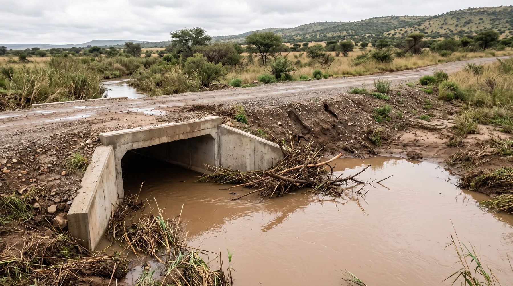
A new access road across a river or stream changes the floodline. The culvert or bridge narrows the flow at the crossing, so in a flood the water backs up behind it and the floodline moves upstream, sometimes onto land that was dry before. The road embankment adds to the effect: until the flood overtops it, it acts as a dam across the floodplain. A crossing therefore needs designing with the floodline, not after it.
Planning an access road across a watercourse? We size the crossing, model the floodline with it in place, and prepare the water use authorisation.
Culvert designHow a crossing raises flood levels
Afflux. Any opening smaller than the natural flood channel forces the flood to pile up upstream until there is enough head to push the flow through. The rise in level upstream is called afflux. Our post on bridge waterway assessments explains it in detail.
The embankment. A road built up across a floodplain blocks the flow outside the opening. Water ponds behind it until it either drains through the culvert or overtops the road. That ponded area is part of the post-development floodline.
Blockage. Culverts collect debris: branches, reeds, litter and sediment. A partly blocked culvert behaves like a smaller one, so the floodline upstream rises again. A crossing that only works when it is clean is not a safe design.
Downstream effects. A crossing that releases flow at high velocity, or overtops at one low point, can scour the channel and banks downstream. Our post on energy dissipators covers outlet protection.
Designing the crossing with the floodline
- Model the river without the crossing to fix the pre-development floodline.
- Size the opening for the design flood the road authority or municipality requires, checking inlet and outlet control. Our post on culvert sizing explains the difference.
- Model the floodline with the crossing in place, including the embankment, and report the afflux at the upstream boundary and at any buildings.
- Run a blockage scenario to see how far the line moves if the culvert is partly blocked.
- Decide how the road overtops, if it will: a defined, protected low point is safer than an uncontrolled one. Our post on low-level river crossings covers crossings designed to overtop.
The post-development floodline from step 3 is the one that matters for platform levels, and for whether the crossing pushes water onto a neighbour. Our post on pre- vs post-development floodlines explains the comparison.
Approvals a new crossing needs
| Approval | When it applies | Source |
|---|---|---|
| Section 21(c) and (i) water use authorisation | A crossing impedes flow and alters the bed and banks, so almost every new crossing in a watercourse or its regulated area needs one: registration under the General Authorisation if the DWS risk matrix rates it Low, otherwise a water use licence | National Water Act; GN 4167 of 2023 |
| Environmental authorisation | Structures with a footprint of 100 m² or more within a watercourse, or within 32 m of one where no development setback exists (activity 12); more than 10 m³ of material moved into or out of a watercourse (activity 19). Activity 12 does not apply inside urban areas, within existing roads and road reserves, or to temporary structures removed within 6 weeks without clearing indigenous vegetation; in listed sensitive areas, Listing Notice 3 activity 14 can apply instead | NEMA EIA Regulations, Listing Notices 1 and 3 |
| Road authority approval | Where the crossing connects to a provincial or national road, or carries a municipal road | The road authority’s standards |
The General Authorisation lists some activities that need no risk matrix, including maintenance of private roads and crossings under 4 m wide that does not change their footprint. A new crossing is not maintenance. Our post on crossing a watercourse covers the water use process.
See our culvert design and floodline determination services, or send us the road alignment.
This post explains the documents listed below. Requirements change and are applied case by case, so confirm them with the relevant authority before relying on them.
Documents referenced
Links go to official government copies wherever one is published online. Check for amendments before relying on a specific clause.
- National Water ActAct · Act 36 of 1998 · Parliament of South Africa
- General Authorisation for water uses under section 21(c) and (i)Regulations · GN 4167 of 2023 · Department of Water and Sanitation
- EIA Regulations Listing Notice 1 (as amended)Regulations · GN 327 of 2017 · Department of Environmental Affairs (gazette copy hosted by KZN EDTEA)
- EIA Regulations Listing Notice 3 (as amended)Regulations · GN 324 of 2017 · Department of Environmental Affairs (gazette copy hosted by KZN EDTEA)
Working on a site where flooding, stormwater, or floodlines are a concern? Send us a message about it and we’ll reply within one business day — no obligation.
Talk to an engineer